Easily access GIS data collected from the field
Autodesk users now have access to content collected by surveyors and field staff who use ArcGIS apps for the field.

Modernise field data collection
ArcGIS apps for the field reduce redundancy and project miscommunication. Increase productivity by eliminating paper-based data collection.

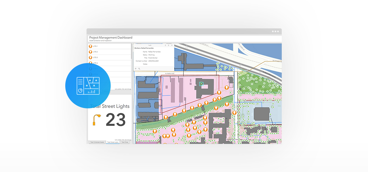
Gaining greater visibility into field activities
Use dashboards to communicate the status of field data collection of built and environmental assets to stakeholders by monitoring, tracking and reporting KPIs in real time.
What’s in the ArcGIS for AEC Field Operations Collection?
This collection is for a surveying, engineering, construction and/or environmental management firm that wants to digitise their field collection work by connecting field workers and office staff to one central cloud database.
ArcGIS Online Creator
Quantity: 1
- Create maps and apps with your data
- Access authoritative data to accelerate your work and expand analysis
- Analyse data to understand trends
- Share maps with stakeholders in a variety of ready-to-use apps
ArcGIS Online GIS Professional Basic
Quantity: 1
- Create maps and apps
- Analyse data to understand trends
- Share maps with your team or the public
- Collaborate with team members
- Administer users and content within the subscription
- Use content from ArcGIS Living Atlas of the World
ArcGIS Online Field Worker
Quantity: 3
- Use apps for data collection, surveys and inspections
- Seamlessly integrate field-collected data
- Share updates with your team in real time
Show More