COVID-19
Maps, resources and insights
Monitor, prepare for and respond to COVID-19

Request GIS help
Esri’s Disaster Response Program can provide GIS help if your capacity is exceeded. Access no-cost resources with a complimentary software subscription.

5 steps to COVID-19 response
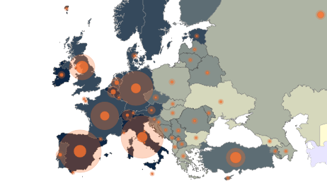
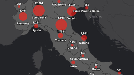
Map the cases
Map confirmed and active cases, deaths and recoveries to identify where COVID-19 infections exist and have occurred.
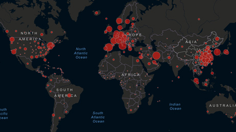
Map the spread
Time-enabled maps can reveal how infections spread over time and where you may want to target interventions.
Map vulnerable populations
COVID‑19 disproportionally impacts certain demographics such as the elderly and those with underlying health conditions. Mapping social vulnerability, age and other factors helps you monitor at-risk groups and regions you serve.
Map your capacity
Map facilities, employees or citizens, medical resources, equipment, goods and services to understand and respond to current and potential impacts of COVID‑19.
Communicate with maps
Use interactive web maps, dashboard apps and story maps to help rapidly communicate your situation so everyone stays aware.
View global maps and dashboards
Get insights
Media Relations
For media inquiries email pr@esriuk.com
View media resources

Esri Newsroom
Explore more articles and publications, press releases and news coverage.
Visit the newsroom

COVID-19 Hub
View COVID-19 updates from trusted sources such as WHO and Public Health England.
View the COVID-19 Hub