Minimising disruptions to facilities and sites
Coronavirus disease 2019 (COVID-19) has had an unprecedented impact on businesses and governments alike, which must continue providing essential services with limited resources. In order to address the current needs of consumers, constituents and internal workforces, while proactively planning for future demands, organisations can leverage location intelligence to assess the status of their facilities in real time. By analysing the spread of the virus with current market opportunities and restrictions, organisations can optimise their sites for the best use.
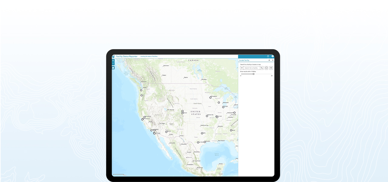
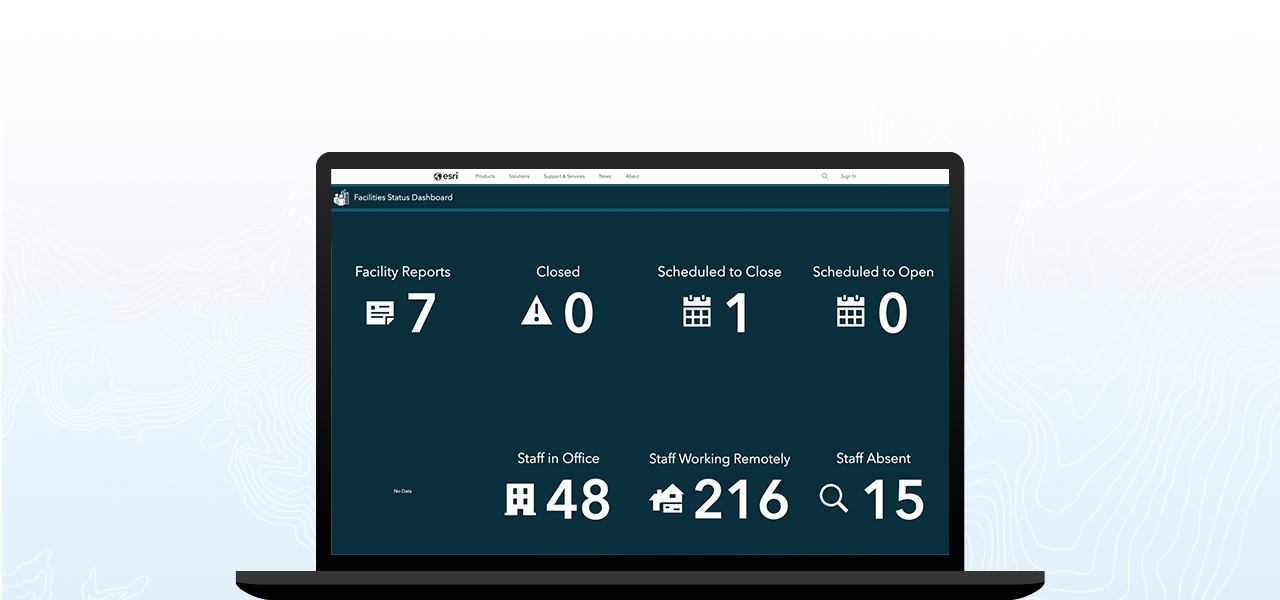
Assessing real-time facility status
Understanding the operating capabilities of facilities can be a difficult and time-intensive process, often requiring integration of dispersed data from spreadsheets and emails into a static document for decision makers. Utilising mobile surveys, organisations can enable field teams to share real-time updates on their facility status from any device. This streamlined approach to data management allows updates from the field to be automatically added to dashboards and web applications for enhanced situational awareness.
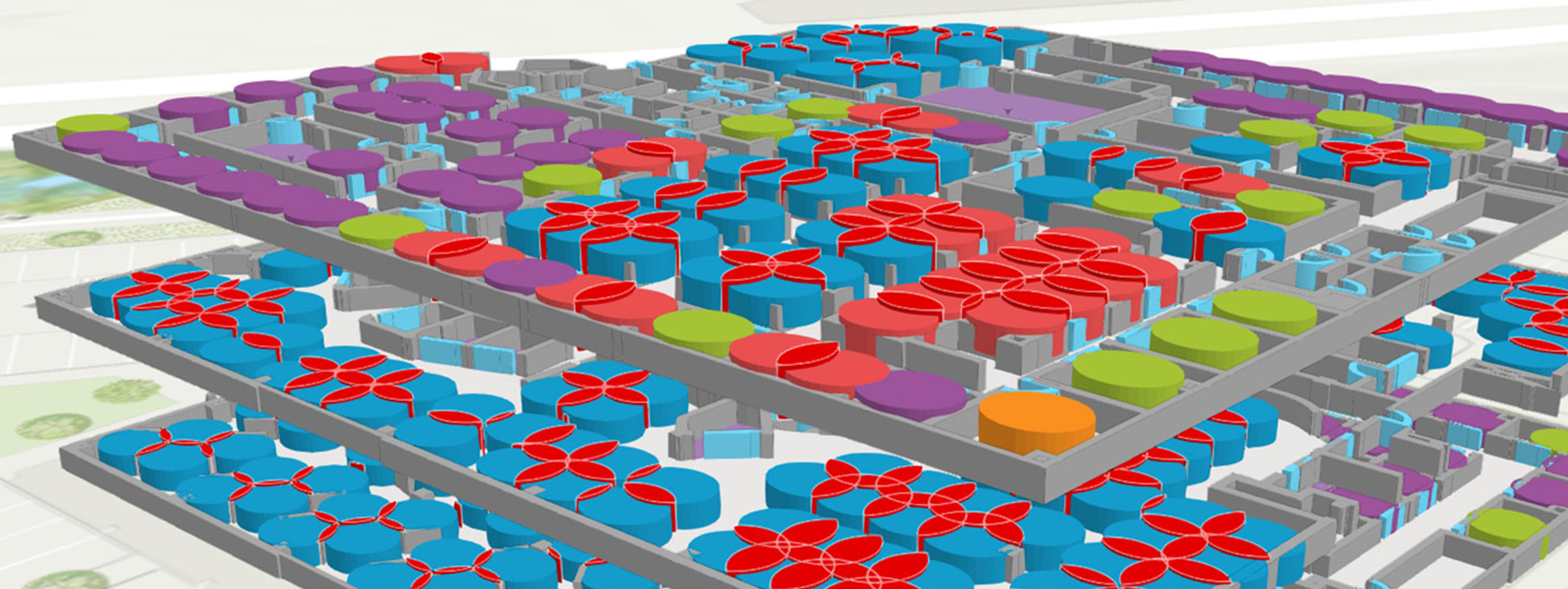
Optimising sites to meet opportunities
Understanding which facilities are open, closed or otherwise impacted by the spread of COVID-19 lays the foundation for reallocating resources to meet current and future market opportunities. Organisations can use location intelligence to determine the highest and best use of a site on a hyperlocal scale, whether that be businesses needing to pivot their in-store operating model to accommodate social distancing and online order fulfillment, or governments needing to determine how to safely offer civil services to their constituents.
Requirements
Recommended software
ArcGIS Online
ArcGIS Pro
Survey 123 for ArcGIS
Additional licenses
Creator
Editor
Viewer
Optional software
ArcGIS Enterprise
Business Continuity Template
article
How to Reopen the Workplace during COVID-19
COVID-19 has undermined workplace safety in profound ways. This is guide for business leaders on reopening the office and ensuring workplace safely.


Esri products for facility status

ArcGIS Online
ArcGIS Online is a complete cloud-based GIS mapping software that connects people, locations and data using interactive maps.

ArcGIS Pro
ArcGIS Pro is a powerful, single desktop GIS application which provides professional 2D and 3D mapping in an intuitive user interface.

ArcGIS Survey123
ArcGIS Survey123 is a complete, form-centric solution for creating smart surveys and forms, collecting data via web or mobile devices and analysing results.