Why we love it
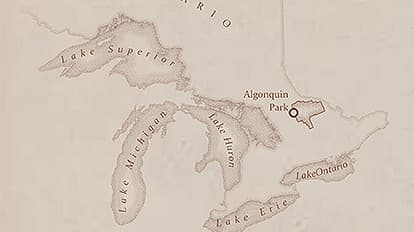
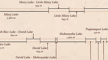
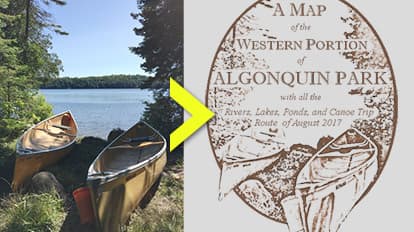
A handmade aesthetic for this map emphasises the rustic nature of the canoe trip. Along the journey, the map author reveals clues to Algonquin Park’s history, including logging artifacts. We get a sense of exploring a new frontier despite being inside a popular, provincial park. The map author uses a stippling symbol effect to soften the hard edges of features. We love how this technique, along with the custom cartouche, reinforces a hand-inked appearance. A graphically rendered trip log highlights strenuous stretches and places where the travelers needed to portage.
Why it works
Several well-chosen cartographic techniques work together to express a uniform aesthetic for this map. Typography and label placement are legible and informative. Only relevant labels are included to avoid visual noise. The scale bar is precise and accurate, making it easy to gauge interim trip distances. The trip breakdown maintains a consistent scale and gives a vivid sense of the paddling versus portaging components of the trip. The inset map is an effective guide to pinpoint the map area relative to recognisable features on the continent.
Important steps
Verify the route
Apply stippling
Breakdown the trip
Create a vignette
Requirements
Data
Analysis
Time
Tips and tricks
Explore symbol effects in ArcGIS Pro
Look for more maps you love
Add more to your map
Resources
Map Author
Warren Davison
GIS analyst by trade and geographer by training. I’m always trying to learn more about cartography skills and make better maps.