Insurance
Smart maps and spatial analytics link position, condition and time to events and interactions. Get the location-based insight you need.

SUCCESS STORY
Gaining deeper insight into global risk
Leading international insurer, RSA, has been using Esri’s ArcGIS technology for over 15 years to help it better understand global perils risk and manage its exposure. Integrated with other core systems, the Esri platform enables RSA’s employees to make better-informed business decisions, as well as respond quickly and effectively to major incidents.
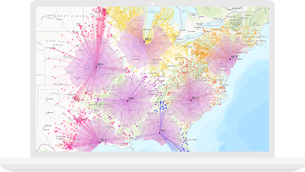
Make the most of every location
Location impacts risk assessment, quotes, claims and client networks. Successful insurance companies go beyond static figures and spreadsheets to get insight into an area's opportunities and risks. Use maps and spatial analytics to improve marketing campaigns, distribution and customer service.
Response management
Prior to flooding and other major events, be proactive - plan ahead for claims handling.

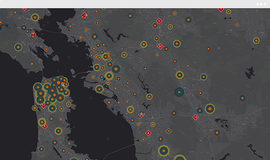
Visibility & transparency
Quickly visualise events with advanced analytics to prioritise response execution.
Investigation & compliance
Effectively serve customers, triage claims and monitor fraudulent activities by embracing location-based intelligence.
Strengthen all aspects of the insurance business.
Empower everyone to use smart maps and spatial analysis in ArcGIS software to understand opportunities and risks.
Business Strategy
Better target limited capital to areas of lower risk or higher opportunity.