Why we love it
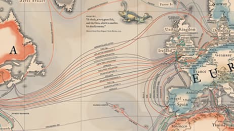
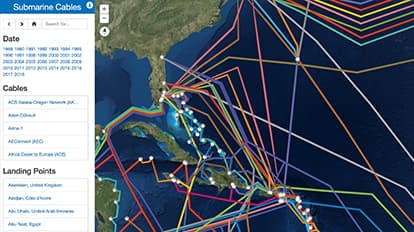
Deep on the ocean floor you will find communication cables made to carry signals from one land to another. The first undersea communications cables, laid in the 1850s, carried telegraphy. Now these cables carry our phone and Internet traffic. Yet, they remain relatively hidden in the depths of the ocean. We love how this map lets us explore global cable connections. We can see the cables all at once or focus on interdependencies by using the contents pane to filter by construction year, a specific cable, or a landing point.
Why it works
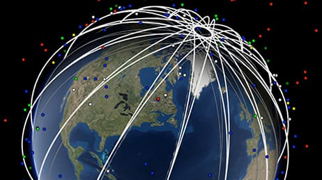
When we view undersea cable data on a global scene view, we get a real sense of how these cables tie together the world’s populated places. This map uses spheres and tubes to symbolize the landing points and cables. This works to emphasize connectivity while remaining playful and easy to understand. When you filter information based on a single cable, landing point, or construction year, you can see interdependencies that are otherwise less obvious. This map does not rely on traditional pop-ups when you select a feature, but instead hides all unrelated features.
Important steps
Download data and convert
Choose an app to design
Create derived data and a Web Scene
Requirements
Data and software
Analysis
Time
Tips and tricks

Use a 3D global
Use a side panel to show information
Use hyperlinks for cross-references
Resources
Map Author
Richie Carmichael
A 15-year veteran at Esri and the Applications Prototype Lab. Trained as a New Zealand land surveyor. Striving for world peace one map at a time.