Why we love it
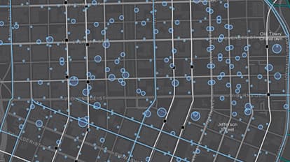
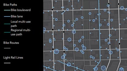
The world is large and maps are small. Cartography is a process of knowing what is essential and what is not. We love how this map uses a muted dark basemap to showcase information that’s pertinent to cyclists. We can clearly see the locations of bike paths and parking, plus light rail transit stops and lines to coordinate cycling/rail combo trips. This map tells an integrated story relevant to cyclists and commuters.
Why it works
At a glance we can see both the locations and amount of bike parking in downtown Portland. This makes it easy to judge the likelihood of finding parking once you get there. Even better, the scale of the map makes it possible to tell which side of the street to go to. The colors, sizes, line weights and opacity amounts help focus our attention on the most important aspects of the map; meanwhile supporting information is offered beneath.
Important steps
Sort the layers
Add transparencies and solids
Use Counts and Amounts styling
Requirements
Data and software
Analysis
Time
Tips and tricks
Easily make unclassed size maps
Read a “how-to” blog post
Map Author
Allan LaFramboise
Geo Developer at Esri, Canuck, husband, mountain biker, dog owner, supporter of all things good.