Why we love it
The COVID-19 pandemic created a widespread impact felt in all corners of the globe, reshaping our routines and constantly providing new challenges to overcome. One of pivotal steps to recovery came through social distancing and ensuring the villages, towns and cities had appropriate space to keep a distance apart. The creation of this pavement widths map provided a resource to local authorities and town planners to guarantee enough space on pavements across England, Scotland and Wales. The striking visual colours immediately indicate areas of narrow and wide pavements, displayed against a dark basemap to really emphasise its cartography.
Why it works
This map was released as a free dataset that was downloaded by over 100 local authorities in the effort to restructure town centres and improve pavement widths. The reason this map works is due to its simple and effective style in providing information, which is having an impact on the infrastructure of urban areas across the country. GIS is at it’s most powerful when it allows real-world decisions to be made based on reliable and informative maps.
Requirements
Data and software
Esri UK created the new interactive map using its ArcGIS Pro 2.5, using the latest MasterMap Topography Layer® from Ordnance Survey (OS).
Analysis
Esri UK extracted the pavement features from the OS MasterMap Topography Layer, then calculated the width of each pavement using ModelBuilder. The pavements were categorised into 3 categories and coloured accordingly.
Time
The map creation took several days to run the ModelBuilder, mainly due to the large number of features spanning across GB. The visualisation and upload to ArcGIS Online was quicker, totalling a week’s effort from start to finish.
Tips and tricks

Esri UK explored a variety of methods but due to the large scale analysis, it was important to create an efficient model. Therefore we used Pairwise tools as it performs faster for larger datasets.
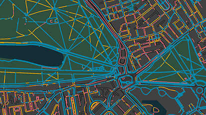
Selecting a dark basemap allowed the colours to stand out and immediately give you a near traffic light set of colours, making it easier to understand.

Using a virtual machine to run the analysis allowed for the tools to run overnight and avoid hitting the local machines spec limits.
Map Author
Sam Bark
Sam Bark is a Cartographer on the Product Communications team at Esri UK. Aside his passion for map design, Sam’s other interests extend to fair-weather cycling, London’s diverse food scene and photography.