Why we love it
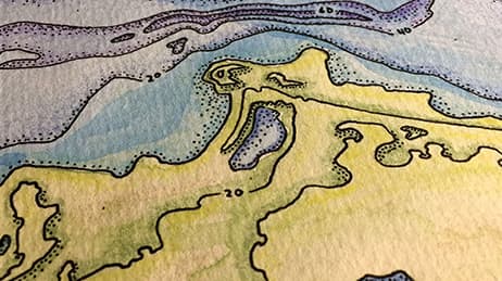
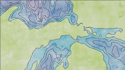
Paper cut maps are a beloved, artful way to model elevation and depth. Traditional paper cut maps require crafting with physical materials—literally cutting construction paper and wood. These Paper Cut Lake Maps are digitally constructed to mimic natural materials. What looks like tangible maps is achieved using advanced digital textures and effects. We love that cartographers are rediscovering and celebrating manual techniques and adding a new level of artistry to modern mapping work.
Why it works
When modern maps are imbued with a hand-crafted aesthetic, they feel more approachable. These digital paper cut lake maps evoke a visceral sense of touch. They look like something we could hold, move our hands across, and experience the contours of the lakes directly. These maps work because they blur the lines between digital and tangible, between historic and modern. In a lovely and sentimental way, the paper cut maps pay homage to the past while delighting in current mapping techniques.
Important steps
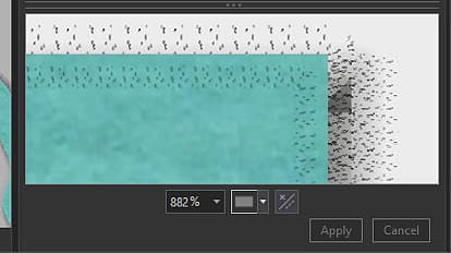
Layer small effects
Repeat textures
Reverse engineer it
Requirements
Data
Analysis
Time
Tips and tricks
Fake the look

Add letterpress
Check as you go
Resources
Map Author
John Nelson
I have way too much fun looking for ways to understand and visually present data, engage others, and write about it. Otherwise, I’m chasing around toddlers and wrangling chickens. Life is good.