Why we love it
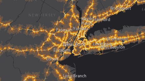
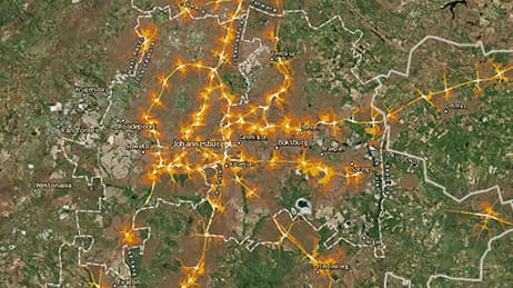
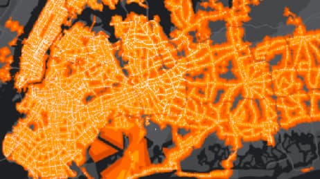
A quick look at this map reveals stunning patterns. Some cities forbid highways from even approaching their centre, while others are surrounded by highways. The map reveals neighbourhood-level detail as well as citywide and even regional patterns. We love the addition of live web cams to help tell the story of European cities and their relationship to highways.
Why it works
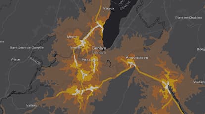
This map shows you right away the areas in Europe within 10 minutes of a highway exit. It makes it easy to understand which cities and even neighbourhoods are most accessible by highway. The colours represent increments of 1-, 3-, 5-, and 10 minutes from a highway exit. The colours get brighter, much like car headlights, to show a city is closer to a highway.
Important steps
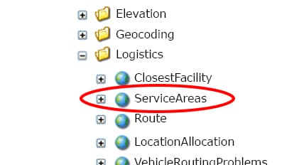
Send set of points to ServiceAreas
Represent drive time
Construct a model
Requirements
Data and software
Analysis
Time
Tips and tricks
Add brighter colours in service areas
Resources
Map Author
Jim Herries
Applied geographer, map curator for Living Atlas of the World and Urban Observatory. I work with talented people to make better maps by eliminating the noise and increasing the signal.