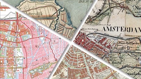
Why we love it
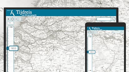
Travel through two centuries of topographic and cartographic history in The Netherlands. This web map app makes it possible to see political, artistic, and scientific forces at work. We love how the simple interface allows just enough interactivity (pan, zoom, search) to draw you into this rich, historic record. Use the timeline slider to see the process of land reclamation, urbanization, and land allocation. Take note of the changes in cartographic style and technology.
Why it works
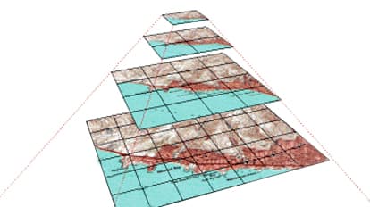
Scanned images of older paper maps are precisely georeferenced so you can exactly compare changes over time. There’s no interference from variations in scale, rotation or projection. Without this, the maps would not register to each other and geographic features would appear to shift between time periods. By using a new digital medium for this historical data and merging it with modern data, we see how a nation’s portrait of itself has changed over 200 years.
Important steps
Georeference the images
Combine all the historical maps in mosaic datasets
Choose tiled services for accessible, online maps
Design easily navigable time and scale maps
Requirements
Data and software
Analysis
Time
Tips and tricks
The application should work on different browsers
Use tiled layers for large target group
Resources
Map Author
Kadaster
The Netherlands’ Cadastre, Land Registry, and Mapping Agency —Kadaster— collects and registers administrative and spatial data on property and rights. Kadaster updates nationwide topographical datasets (10K – 500K) on a bi-annual cycle.