Why we love it
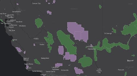
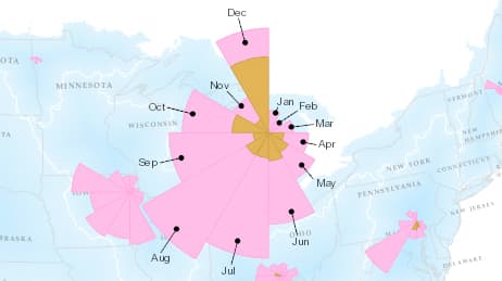
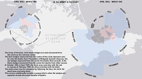
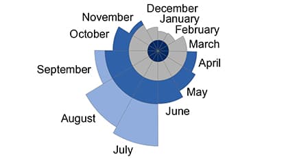
A coxcomb chart (first used by Florence Nightingale) is a great way to display multiple facts at one location over time. We love how this map shows quantity and seasonal variation as part of the display, so you don’t have to use pop-ups or multiple maps to get a full picture of bird-related airstrikes on civilian aircraft. The graphic legend is not hidden—a good choice for this map. We also love that as you zoom, the analysis is resampled to create finer resolution coxcombs.
Why it works
A terrific amount of information is packed into this map. It’s easy to see regional differences and distinct seasonal patterns around the country. Each segment of the coxcomb diagram represents a unique time period and quantity. Because the sectors all have the same angle, they are visually equivalent when used to represent area. This makes the chart easy on the eyes, and the multiple wedge-shaped proportional symbols help us understand differences in quantity.
Important steps
Download the coxcomb tool
Launch the coxcomb tool
Workflow assumptions
Requirements
Data and software
Analysis
Time
Tips and tricks
Use coxcombs for time periods
Add custom legends to map view
Resources
Map Author
Ken Field
Professional cartonerd, amateur drummer and snowboarder. Lifetime encourager of cartographic quality not quantity. Map with the times while building on the past.